

After a taste of record-breaking cold and more snow impacted southeast Iowa over the weekend, more records may be broken this week for an arctic blast of air settling into the area.
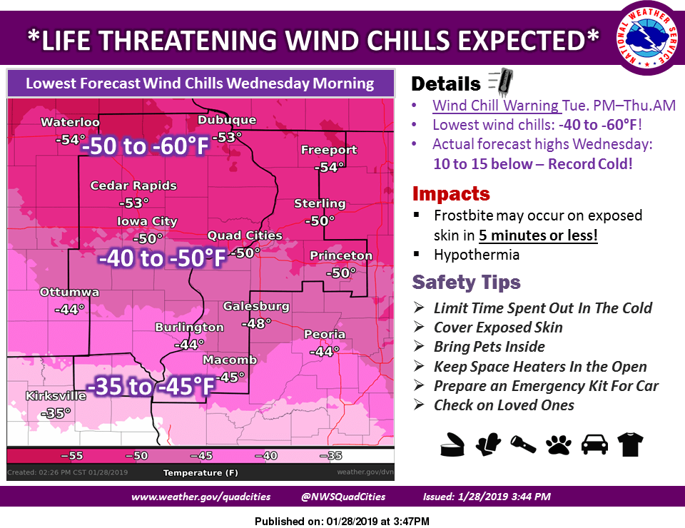
Overnight and early morning low air temperatures will drop twenty degrees or below zero tonight (Tuesday) and Wednesday, according to the National Weather Service, with the wind making that air feel like it’s 45 to 50 degrees below zero. Frostbite and hypothermia can occur in as little as five to ten minutes with exposed skin.
A low of 19 below zero degrees broke a previous record on Saturday morning, and the current forecast shows both daytime high and overnight low temperatures will approach and possibly break more records.
Residents are reminded to stay indoors whenever possible, and to make sure pets are safe by limiting any time outside. A break from the bitter cold is expected by the weekend, with temperatures projected to climb above 40 degrees by Saturday and Sunday afternoon.
Stay tuned to KCII for the latest winter weather information, including the latest cancellations and delays for area schools and community events.
RECORDS:
January 29th records –
Coldest high: 3 degrees (1951)
Coldest low: -16 (1895)
January 30th records –
Coldest high:-1 (1996)
Coldest low: -22 (1996)
January 31st records –
Coldest high: -3 (1996)
Coldest low: -19 (1918)