

There is a chance of some severe weather for the area this evening according to the National Weather Service of the Quad Cities.
Any storms that are able to form will be capable of producing large hail up to the size of golf balls, and a potential for tornadoes. A damaging wind threat increases with time, as
storms grow into organized lines.
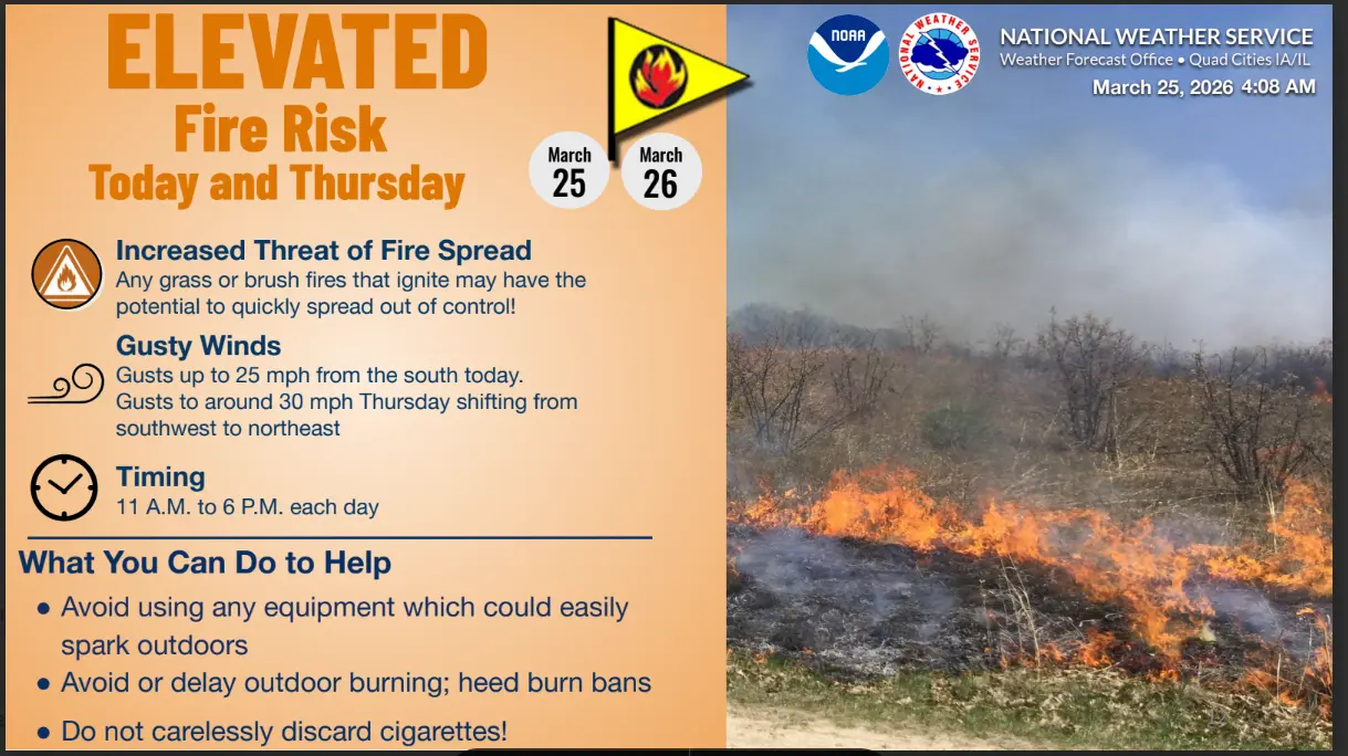
Before any precipitation, there is an increased threat of fire spreading due to dry conditions. Any grass or brush fires that ignite may have the potential to quickly spread out of control. Wind gusts to around 30 mph are possible today shifting from southwest to northeast. It is recommended to avoid using any equipment which could easily spark outdoors. Delay outdoor burning and heed burn bans.
Washington County Officials have responded to 13 fire calls as of Wednesday this week due to uncontained controlled burns.
Tune into KCII for all of your weather updates.