

Today, for Severe Weather Awareness Week the focus is wind and hail.
Thursday, highlights a pair of hazards observed in southeast Iowa during the season: hail and wind. These two impacts typically visit our area in the form of severe thunderstorms. According to the National Weather Service, severe thunderstorms are defined as those capable of producing hail one-inch in diameter and larger, or wind gusts of 58 miles per hour or stronger.
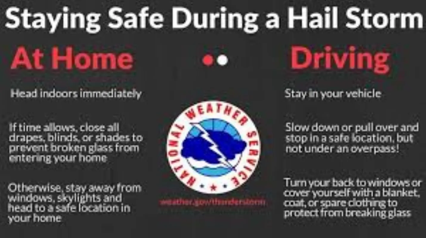
Hail of that size is capable of damaging property including roofs, siding, trees and vehicles. Winds of that caliber are able to break off large branches or knock over trees, causing structural damage to buildings and power outages. The NWS says that in recent years, trained weather spotters in the state have reported hail as large as softballs and winds in excess of 100 mph. During strong winds and hail events, it is recommended to go to the innermost part of your home, or basement.
The KCII Severe Weather Action team provides live coverage any time Washington County is under a severe thunderstorm or tornado warning. With our backup generators, even during a power outage, live coverage continues on KCII Radio and on our mobile app. The one to count on for up-to-the-minute severe weather coverage is KCII. On Wednesday KCII participated in the state-wide tornado drill as part of Severe Weather Awareness Week.
Severe Weather Awareness Week wraps up tomorrow with flood safety.